Mount Gambier · South Australia
Piccaninnie Ponds
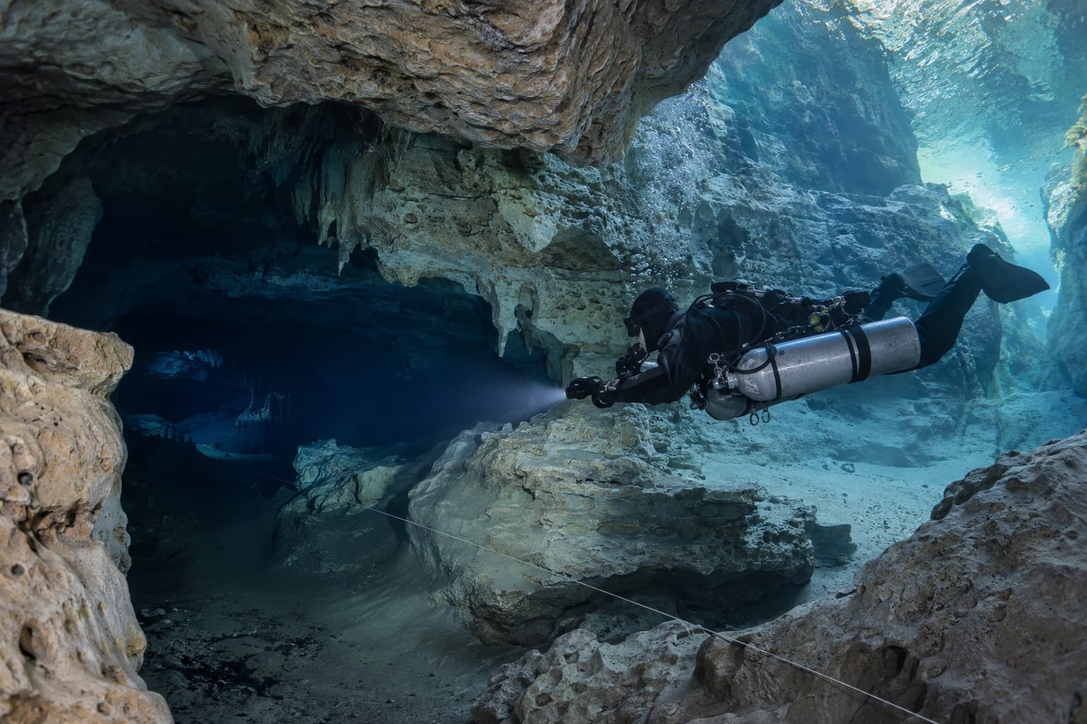
A karst spring of extraordinary clarity, with the Cathedral chamber and a chasm beyond 100 metres.
Piccaninnie Ponds is a karst spring system near the Victorian border, fed by groundwater filtered through limestone and known for clarity that can exceed 40 metres.
The main features are the First Pond, the Cathedral — a white limestone chamber — and the Chasm, which descends beyond 100 metres.
Access is permit-controlled and requires appropriate CDAA qualification for the deeper and overhead sections. Snorkelling permits are also issued for the shallow areas.
Max depth
100 m
typically 20 m
Access
shore
Current
minimal
Water temp
15–17°C
Level
technical
| Region | Mount Gambier |
|---|---|
| State | South Australia |
| Access | shore |
| Site type | sinkhole, cave |
| Minimum depth | 0 m |
| Typical depth | 20 m |
| Maximum depth | 100 m |
| Current | minimal |
| Visibility | Exceptional — often beyond 40 m |
| Water temperature | Roughly 15–17°C |
| Experience level | advanced, technical |
These are guidance categories, not guarantees. Conditions on the day, and an operator’s own requirements, override any classification here.
- Minimal — freshwater karst systems support very little life, which contributes to the clarity.
Access
- Permit required through the relevant park authority.
- CDAA qualification required for cave sections.
- Snorkelling permitted in shallow areas.
- Freshwater weighting differs from ocean diving.
Hazards
- extreme depth in the Chasm
- overhead environment
- clarity causing depth misjudgement
- cold water over long dives
- silt in some areas
Operators servicing this site
Businesses documented as regularly diving this site. Only operators we have established a connection for are listed.
Training that is genuinely useful here
Not a list of everything available — the qualifications that actually change what you can do at this site.
Technical background
Related dive sites
Worth reading alongside this one.
Dive sites nearby
Other documented sites within range, nearest first — useful for building a trip rather than a single dive.
Frequently asked questions
How deep is Piccaninnie Ponds?
Depths range from around 0 metres to roughly 100 metres, with a typical profile around 20 metres. Conditions and route selection change this considerably.
Is Piccaninnie Ponds suitable for beginners?
It is better approached with experience beyond entry level. Depth, current or exposure make this demanding regardless of what a certification card permits. Discuss your recent diving honestly with the operator rather than relying on certification alone.
How do you get to Piccaninnie Ponds?
Access is shore based. Permit required through the relevant park authority.
Is there current at Piccaninnie Ponds?
Current is recorded as minimal. Conditions vary daily and should be checked close to the day.
What will I see at Piccaninnie Ponds?
Commonly reported marine life includes Minimal — freshwater karst systems support very little life, which contributes to the clarity.. Sightings are never guaranteed.
When is the best time to dive Piccaninnie Ponds?
Conditions vary through the year. Visibility is exceptional — often beyond 40 m. Check with local operators close to your dates.
Where is Piccaninnie Ponds?
Piccaninnie Ponds is in the Mount Gambier region of South Australia.
Last researched: September 2026. Dive businesses change frequently — confirm current services, prices and requirements directly with the operator before booking.