Tasman Peninsula & Eaglehawk Neck · Tasmania
SS Nord
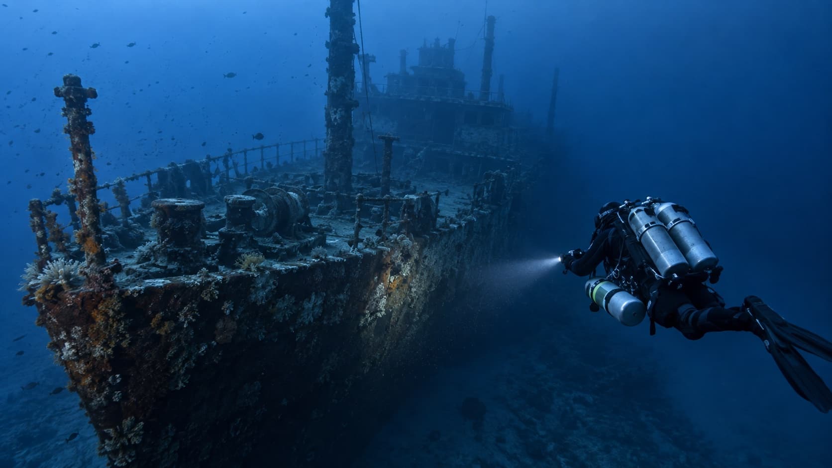
A steamer lost in 1915, lying around 42 metres off the Tasman Peninsula.
The SS Nord, a steamer lost in 1915, lies around 42 metres according to official Tasmanian tourism information, putting much of the wreck beyond ordinary entry-level recreational limits.
The wreck is largely intact and well preserved in the cold water, and it is among the most significant wreck dives in Tasmania.
Honest coverage has to separate recreational observation of the shallower structure from the deep-diving requirements, decompression planning and technical options that reaching the rest of the wreck involves.
Max depth
45 m
typically 42 m
Access
boat
Current
variable
Water temp
11–17°C
Level
technical
| Region | Tasman Peninsula & Eaglehawk Neck |
|---|---|
| State | Tasmania |
| Access | boat |
| Site type | wreck |
| Minimum depth | 30 m |
| Typical depth | 42 m |
| Maximum depth | 45 m |
| Current | variable |
| Visibility | Commonly 10–25 m |
| Water temperature | Roughly 11–17°C |
| Experience level | advanced, technical |
These are guidance categories, not guarantees. Conditions on the day, and an operator’s own requirements, override any classification here.
- sponge and soft coral colonisation
- butterfly perch
- crayfish
- temperate reef fish
- occasional seals
Access
- Boat access from Eaglehawk Neck.
- Exposed location — weather-dependent.
- Depth requires appropriate training and gas planning.
Hazards
- depth beyond recreational limits
- cold water extending decompression obligations
- current
- overhead if penetration is attempted
- limited bottom time
Operators servicing this site
Businesses documented as regularly diving this site. Only operators we have established a connection for are listed.
Training that is genuinely useful here
Not a list of everything available — the qualifications that actually change what you can do at this site.
Technical background
Related dive sites
Worth reading alongside this one.
Dive sites nearby
Other documented sites within range, nearest first — useful for building a trip rather than a single dive.
Other dive businesses in the area
Not documented as servicing this site, but close enough to be useful for fills, hire or advice.
Frequently asked questions
How deep is SS Nord?
Depths range from around 30 metres to roughly 45 metres, with a typical profile around 42 metres. Conditions and route selection change this considerably.
Is SS Nord suitable for beginners?
It is better approached with experience beyond entry level. Depth, current or exposure make this demanding regardless of what a certification card permits. Discuss your recent diving honestly with the operator rather than relying on certification alone.
How do you get to SS Nord?
Access is boat based. Boat access from Eaglehawk Neck.
Is there current at SS Nord?
Current is recorded as variable. Conditions vary daily and should be checked close to the day.
What will I see at SS Nord?
Commonly reported marine life includes sponge and soft coral colonisation, butterfly perch, crayfish, temperate reef fish, occasional seals. Sightings are never guaranteed.
When is the best time to dive SS Nord?
Conditions vary through the year. Visibility is commonly 10–25 m. Check with local operators close to your dates.
Where is SS Nord?
SS Nord is in the Tasman Peninsula & Eaglehawk Neck region of Tasmania.
Last researched: September 2026. Dive businesses change frequently — confirm current services, prices and requirements directly with the operator before booking.